Description
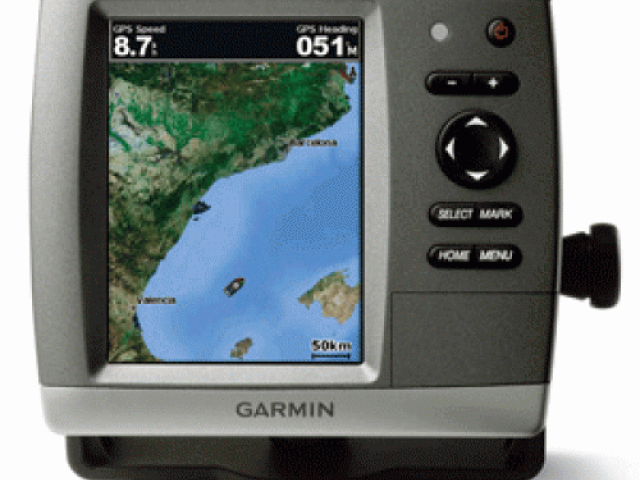
GPSMAP 526 Chartplotter
Even in bright sun, it is easy to see the clarity of the GPSMAP 526. These brilliant 5″ VGA displays give you a sharp, clear picture, and the fast processor makes fr smoth panning and screen redraws as you scroll. Plus, these waterproof units have a high-sensitivity internal GPS receiver, so mariners will always know their position at sea. It’s ready to go with a built-in, satellite enhanced worldwide basemap and Garmin’s proven easy-to-use interface designed to help mariners navigate the open waters with ease.
Features and Specifications:
Brilliant, crisp 5″ diagonal VGA display, 480 x 640 pixels – over 800 nits of brightness
NMEA 2000 certified for seamless integration with the Garmin marine lineup
Preloaded worldwide marine basemap
Compatible with GXM 51 for XM Satellite Radio and XM WX Satellite Weather
Built-in high-sensitivity GPS receiver
High-speed processor for fast screen redraws and smooth panning
Streamlined user interface makes it simple to select modes and features
Single SD memory card slot for BlueChart g2 Vision cards, as well as saving waypoints, routes and tracks to an SD card
Optional BlueChart g2 Vision cards provide marine chart detail and enhanced navigation features like Auto Guidance, satellite imagery, 3-D Mariner’s Eye View and 3-D Fish Eye View
Backlit keypad for easy operation in low light conditions
Unit dimensions: 5.9″H x6.4″W x 2.9″D