Description
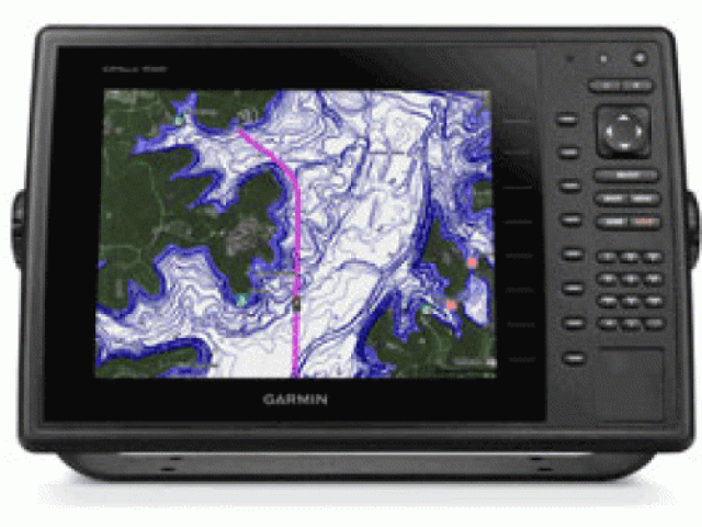
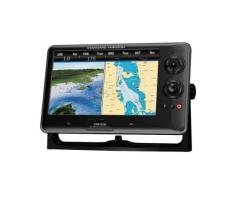
GPSMAP 1020
The 10″ color GPSMAP 1020 keyed chartplotter has a preloaded worldwide basemap. The built-in 10 Hz GPS/GLONASS receiver updates your position and heading 10 times per second.
With NMEA 2000 support for autopilot capability, engine data, SiriusXM Weather and more, the GPSMAP 1020 is compatible with LakeVu HD Ultra, BlueChart g2 and BlueChart g2 Vision. It also supports all Garmin marine radar.
For even more functionality, wirelessly connect to Apple (mobile digital device) for BlueChart Mobile. The chartplotter includes 2 SD data card slots, allowing for gigabytes of storage. It can be flat, flush or bail mounted.
Networking
The GPSMAP 1020 offers select networking capabilities that allow you to share features with other compatible GPSMAP units, such as radar, GCV 10 DownV
and SideVu scanning sonar, supplemental maps, and user data, such as waypoints, routes and tracks.
Special Sailing Features
Supported sailing features include laylines, enhanced wind rose, heading and course-over-ground lines, and true wind data fields.
Features:
10″ Keyed Chartplotter for Cruising, Sailing or Fishing
10″ color SVGA display with keyed control
Preloaded with worldwide basemap
High-sensitivity internal 10 Hz GPS/GLONASS receiver
Compatible with LakeVu HD Ultra, BlueChart g2 and BlueChart g2 Vision
Supports all Garmin marine radar
Package Includes
Package Includes:
GPSMAP 1020 with worldwide basemap
Power/data cable
Bail mount
Flush mount
Protective cover
Documentation