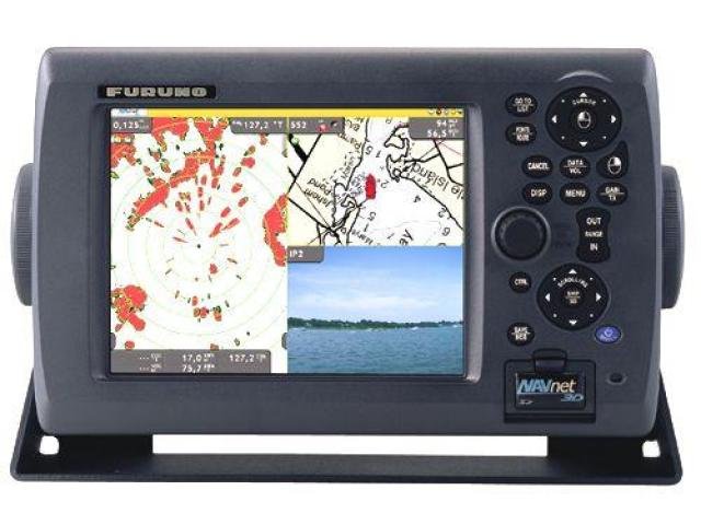
Description
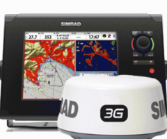
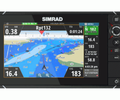
Furuno NavNet 3D 8.4” Color Multi Function LCD Display Standard Features:
Chart scaling without limitation
Pre-loaded with NOAA raster chart library for entire U.S. coastline including Alaska and Hawaii
TimeZero™ technology facilitates instant chart redraw, allowing zooming in and out, chart panning, changing chart display modes and other chart handling functions seamlessly and with no lag time
Full Time 3D chart rendering. Choose a 2D top-down view of the navigation chart for a traditional chart plotting presentation, or choose to pan and zoom the chart to any angle at any range scale you choose
Pan the chart using the scroll pad, and then instantly return to own ship at the touch of a single dedicated key
Zoom seamlessly and continuously to whatever chart scale you desire – TimeZero™ architecture allows you to seamlessly zoom in or out to the exact magnification level you like without steps or limitations
No “3D mode” to change into and no waiting – NavNet 3D operates in a 3D environment full-time
Fuse satellite photography with raster or vector chart information. Land areas (zero depth) are completely opaque, so that these areas are displayed as high-resolution satellite photos on the chart. As the depth increases, the satellite photography becomes more transparent so that you will know where the shallows end and the deeper water starts, while allowing the raster or vector chart to be visible
More than 12,000 ship’s track points and over 2,000 waypoints
200 planned routes, with up to 100 waypoints/route
Preloaded tides & currents
Engine monitoring
Built-in ARPA processor can simultaneously acquire and track up to 30 targets (with appropriate sensor)
AIS tracking when connected to AIS receiver – AIS input via Ethernet (FA30 or FA50) or AIS NMEA0183
True color depth shading utilizing bathymetric data
Standard video input and outputs
Furuno NavNet 3D 8.4” Color Multi Function LCD Display Network Sensor connection from Radar
All NavNet 3D radar sensors incorporate a Network port to which certain Furuno sensors can be directly connected
Power for Furuno network sensors is supplied directly from the radar, allowing for flexible installation of multiple sensors without the need to run cables to the main processor unit
Data from Furuno network sensors is converted and distributed throughout the NavNet 3D Ethernet network
Furuno NavNet 3D 8.4” Color Multi Function LCD Display Easiest user interface on the market
Simple operation with a combination of both RotoKey™ and a familiar point-and-click cursor pad control
By turning a rotary knob on the control panel, RotoKey™ will be activated, giving you full access to NavNet 3D controls
A short press of the RotoKey™ gives you access to a user-selected set of the functions that you select upon installation from Basic, Standard, Full or Custom, while a longer press of the key displays all of the functions available
The power of the point-and-click interface allows for incredibly simple operation – click anywhere on the screen for context-sensitive options for that area. Click on any data box to access detailed information for that function. A variety of features can be accessed through a familiar left or right click interface
Connect a generic USB mouse to further simplify operation
Furuno NavNet 3D 8.4” Color Multi Function LCD Display Fully digitized environment with add-on components
Highly sensitive digital sensors for radar and fish finder, delivering total fusion of hardware and software
Ultra High Definition (UHD™) Digital Radar offers crystal clear, noise-free target presentation with automatic real-time digital signal processing
Real-time digital auto Gain/Sea/Rain controls to deliver noise-free radar presentation
Radar antenna rotation speed (24/36/48 rpm) is automatically shifted to the appropriate pulse length
Simultaneous scanning technology drives our powerful dual-range radar, providing unsurpassed target detection. With each sweep of antenna, dual progressive scan transmissions are sent, received and processed to display two separate radar ranges on your NavNet 3D display simultaneously. Each radar presentation acts autonomously, allowing for manipulation of individual gain and clutter controls
Sirius Satellite Weather overlays chart with highly accurate information, requires Sirius receiver and subscription
Optional Weatherfax/Navtex receiver available
External alarm output & point/MOB alert input
Control up to 4 AXIS IP cameras